Gallery
Explore our comprehensive collection of professional figures for use in your landscape and visual impact assessments.
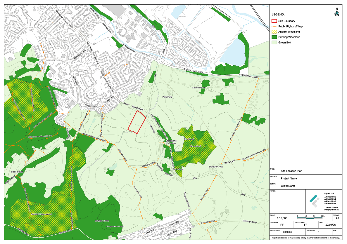
Site Location
Shows the location of the Site in its wider geographic context, including surrounding settlements and key transport links.
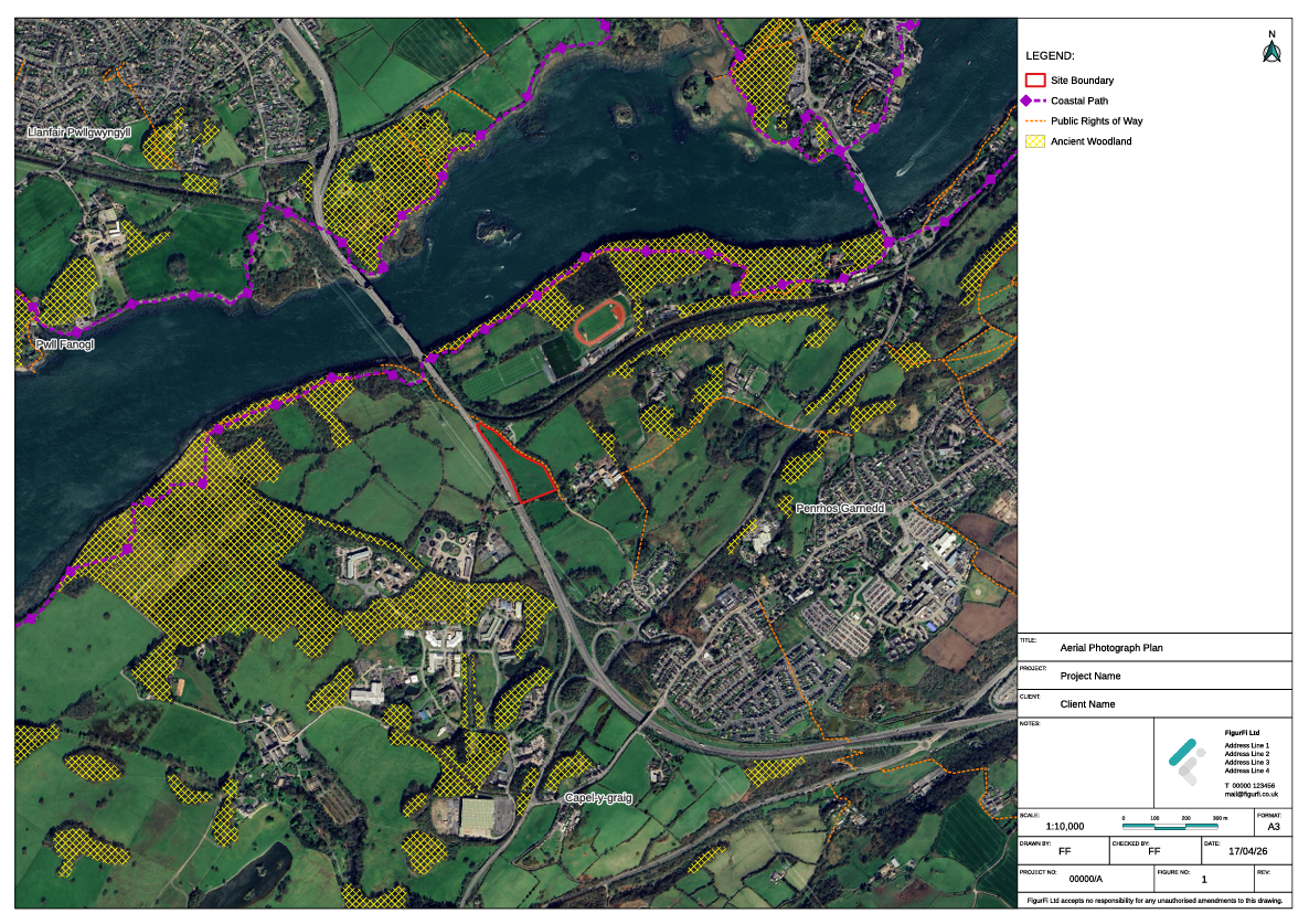
Aerial Photograph
Provides aerial imagery to illustrate existing land cover, surrounding development, and landscape context.
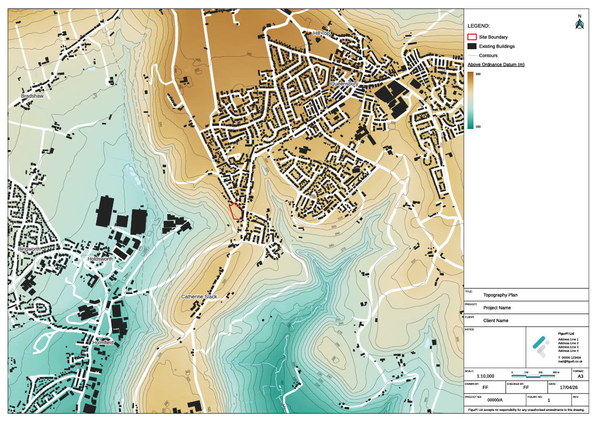
Topography
Illustrates landform and levels within and around the Site, highlighting key changes in elevation.
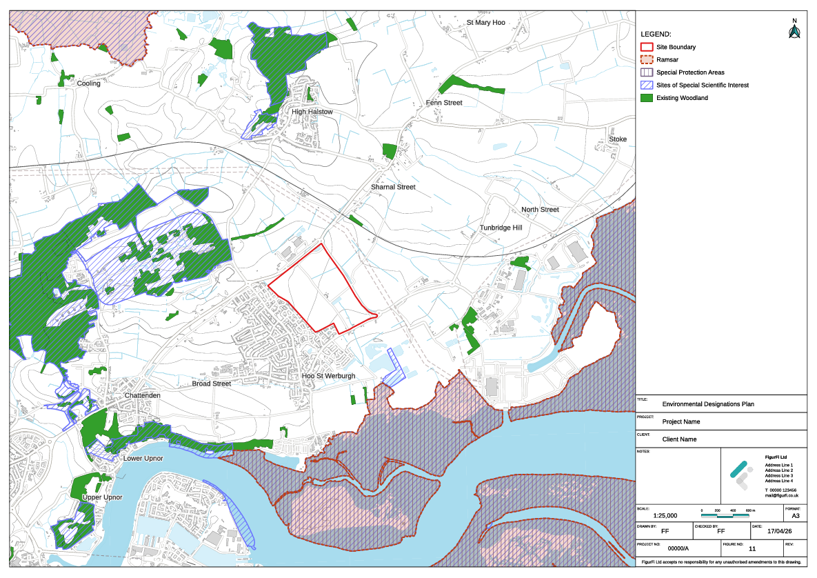
Environmental Designations
Identifies statutory environmental designations in proximity to the Site, such as SSSIs, SACs, SPAs, and Ramsar sites.

Planning Context
Shows the Site in relation to adopted and emerging planning policy boundaries and nearby allocated land.
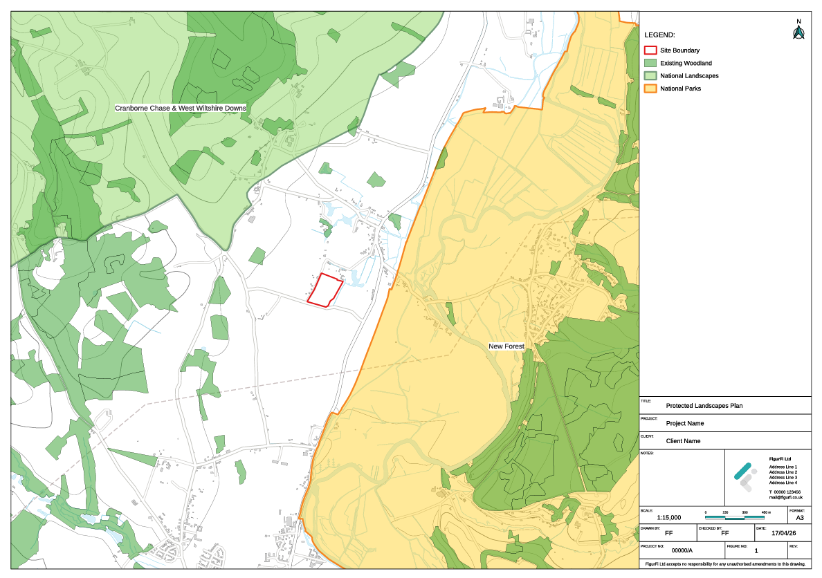
Protected Landscapes
Identifies nationally designated protected landscapes, including National Parks, the Broads and National Landscapes.
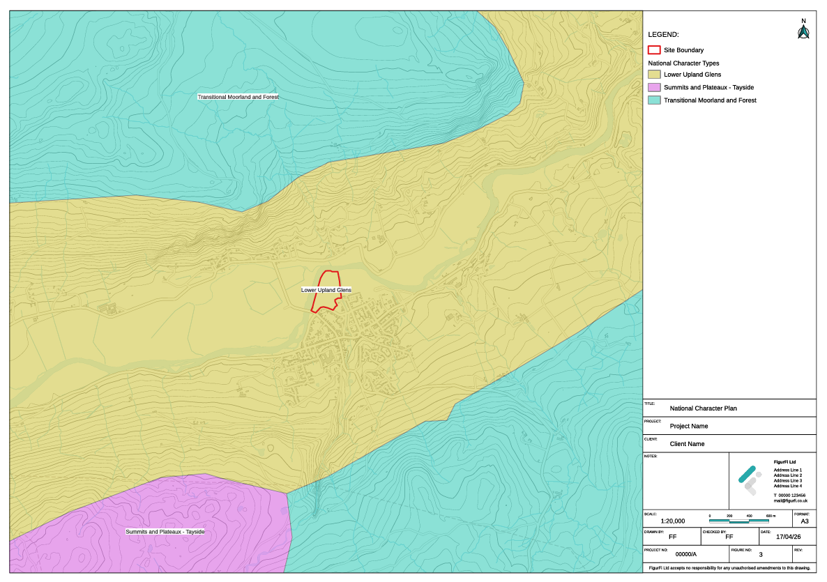
National Character
Illustrates the extent of published national character areas or types in the vicinity of the Site.

Local Character
Illustrates the extent of published local landscape character areas or types in the vicinity of the Site.
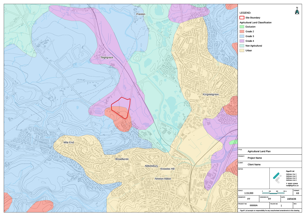
Agricultural Land
Outlines the agricultural classification or capability of land in the vicinity of the Site.
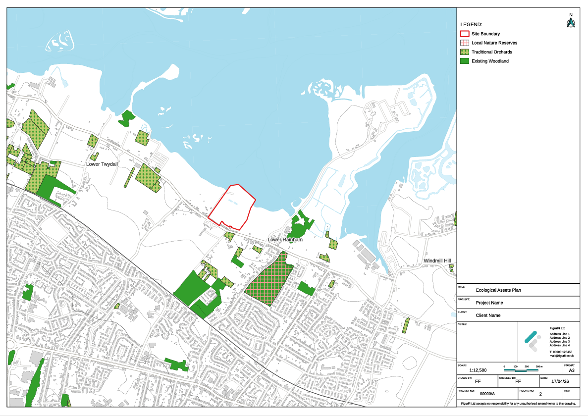
Ecological Assets
Illustrates designated and non-designated ecological assets and priority habitats.

Heritage Assets
Shows designated and non-designated heritage assets, including listed buildings, conservation areas, and scheduled monuments.

Building Heights
Illustrates existing building heights in the surrounding area to provide development context.
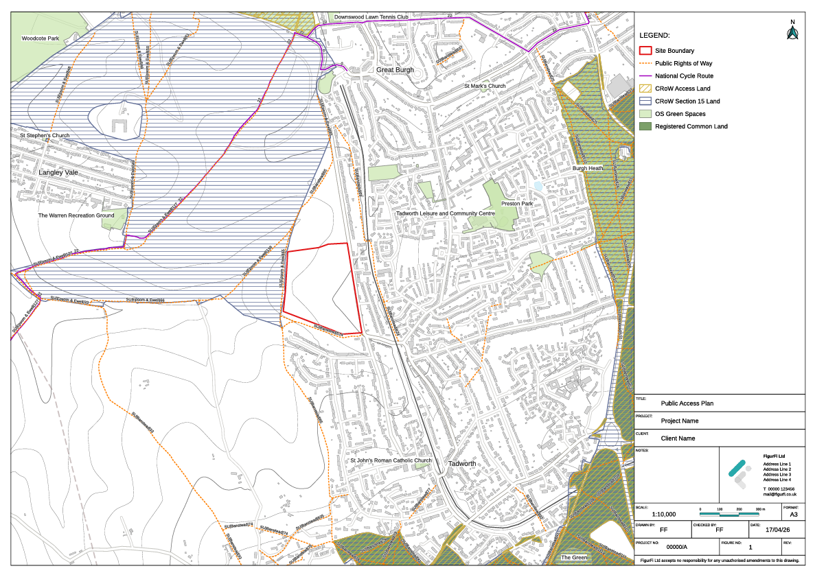
Public Access
Identifies Public Right(s) of Way(PRoW), access routes, and recreational assets within and around the Site.
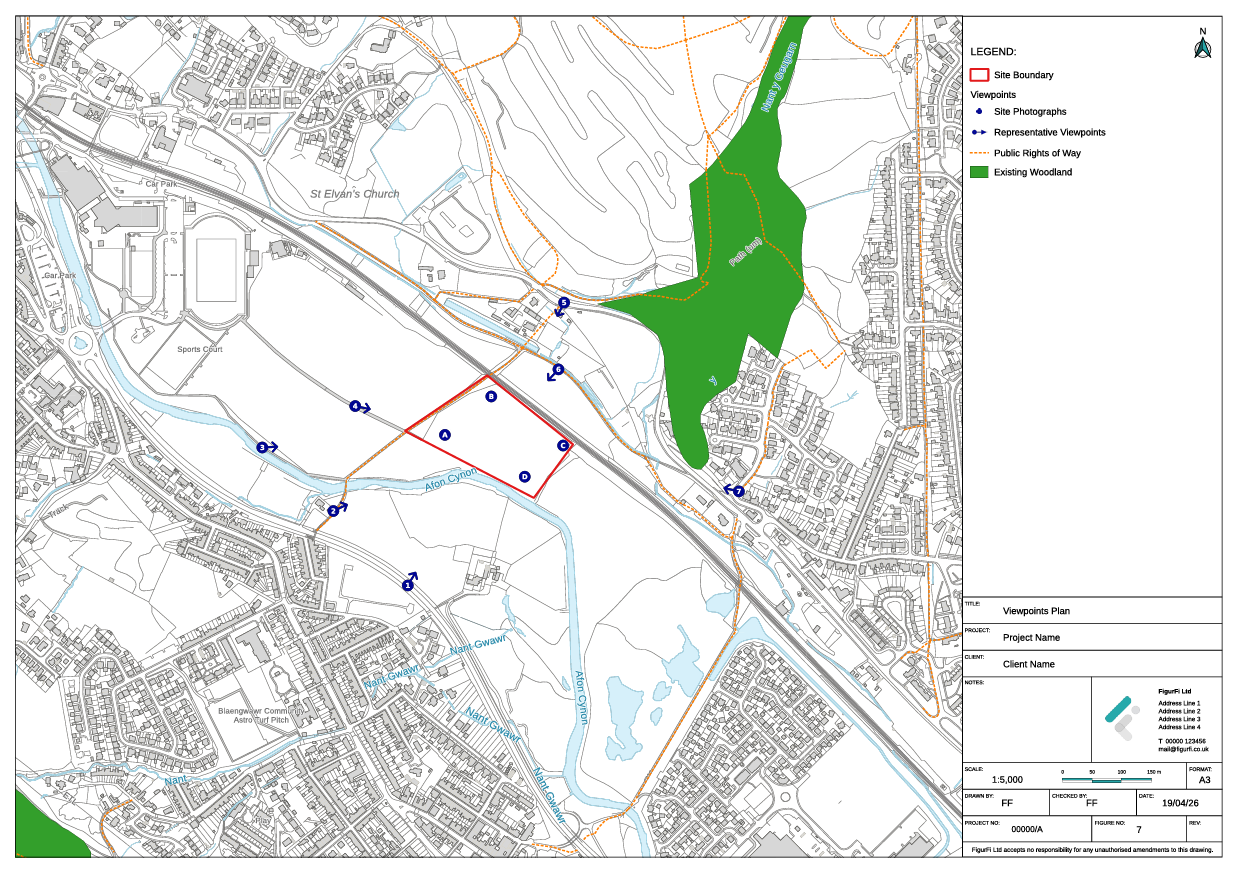
Viewpoint Locations
Shows the location of representative viewpoints.
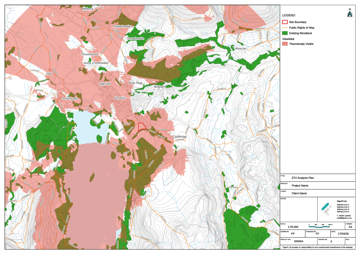
ZTV Analysis
Illustrates theoretical visibility of the Proposed Development based on a bare-earth scenario.
Need Something Different?
Don't see exactly what you need? We can create custom templates tailored to your specific project requirements.
Request Custom Figure